Ten Thousand Islands National Wildlife Refuge is not the kind of place where one overlook tells the whole story. This broad sweep of mangrove islands, brackish marsh and shallow backwater is best approached in two ways: from the Marsh Trail beside U.S. 41, or by boat from Goodland or Port of the Islands. Pick the option that fits your comfort level, the day’s wind and the tide—not just the distance on a map.
Start on the Marsh Trail
For a land-based introduction, use the refuge’s main mainland access: the Marsh Trail parking area on the south side of U.S. 41, near mile marker 31. It is about three miles east of Collier-Seminole State Park and has just 18 spaces, so arriving early is wise. From I-75’s Exit 101, follow Collier Boulevard south to U.S. 41, turn left, and continue about 11 miles.
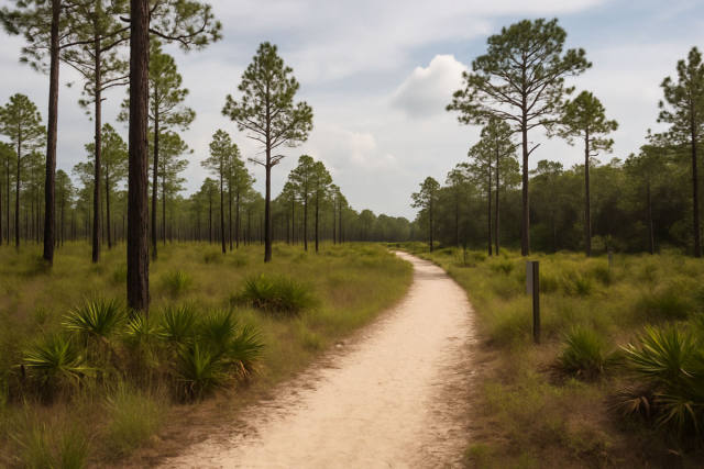
The Marsh Trail is a 2.2-mile round trip. Its first quarter-mile is paved, while the remainder is a wide gravel road, making it a manageable choice for most visitors. At the end, climb the two-story observation tower for a much wider view over the marsh; its lower level is accessible, and the tower has benches and viewing scopes. Give yourself at least an hour, more if you like to birdwatch or photograph.
Winter, roughly October through March, is especially rewarding for birds. Look patiently for egrets, herons, white ibis, roseate spoonbills, wood storks, osprey and bald eagles. The quietest wildlife-viewing approach is the best one: stay on the trail, speak softly and never crowd birds into flight. A pair of compact binoculars will be more useful here than a long lens alone.
Kayaking the north-marsh trails
The refuge maintains four short canoe-and-kayak trail routes off U.S. 41. Their published lengths are 0.71 mile, 1.30 miles, 1.26 miles and 1.48 miles. They are an appealing way to slip into the northern marsh, but they are not plug-and-play rentals-and-launches: the refuge does not provide parking for Trails 1, 3 or 4. Trail 2 is the practical choice to investigate first if you want a refuge-designated paddle with formal parking nearby.
More importantly, water levels in the northern marsh change dramatically with season. The refuge notes that these routes are generally most accessible from midsummer into early winter, but conditions can change quickly. Before committing to a U.S. 41 launch, call the refuge at 239-657-8001 for current water levels and route guidance. Bring your own boat; the U.S. Fish and Wildlife Service does not provide rentals or guided trips here.
Use a real-time map, a compass backup and a waterproof phone pouch. Marsh channels can feel wonderfully remote, but grass, low water and changing light can make a short outing more complicated than expected.
Best public launches for a bigger boat day
Goodland Boating Park, at 740 Palm Point Drive, is the straightforward western option for reaching Goodland Bay, the Ten Thousand Islands and the Gulf. The county park has a two-lane ramp, trailer parking, wet slips, a fishing pier and a life-jacket loan program. It is open year-round from sunrise to sunset. For a first outing, this is the better base for a conservative out-and-back cruise through protected bays and mangrove edges, rather than a long crossing into exposed Gulf water.
Port of the Islands Marina, at 525 Newport Drive in Naples, is the eastern option. It has one oversized launch ramp and a large parking area, and it puts boaters closer to the refuge’s eastern waterways. The marina is also a worthwhile wildlife stop: manatees are often visible around Port of the Islands. It is open sunrise to sunset; its ship store is currently closed, though credit-card fuel sales are offered daily from 7 a.m. to 1 p.m., except Christmas Day.
At Collier County boat parks, the current daily launch fee is $5 for non-motorized vessels and $10 for motorized vessels. Visitors who are not eligible for the county’s resident beach-parking permit may also pay a $10 daily vehicle parking fee. Payment is handled at county pay stations or, at Goodland and Port of the Islands, through the T-2 mobile-payment system. Check current fees and launch conditions before leaving home.
Route and wildlife strategy
For kayakers, stay inside protected bays, creeks and mangrove margins unless you have sea-kayaking experience and a calm marine forecast. For motorboats, use marked channels, respect shallow-water hazards, and slow down near shorelines, manatees and feeding birds. Wind can build a short, uncomfortable chop in open water, while tidal flow can make narrow passes work much harder than expected. Plan a turnaround time, carry ample drinking water, wear a properly fitted PFD and keep a close eye on weather.
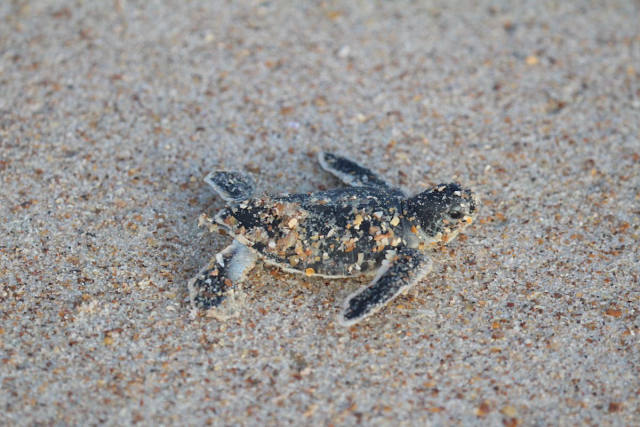
Manatees and dolphins are commonly seen in the refuge’s rivers and bays; summer visitors may also encounter protected sea turtle nesting activity on outer barrier islands. Leave plants, animals, nests and shells where they are, keep pets on a six-foot leash, and remember that drones may not take off or land on refuge lands.
Practical takeaway: For a low-stress first visit, do the Marsh Trail early, then choose Goodland or Port of the Islands for a tide-aware, out-and-back water excursion rather than trying to cover the entire Ten Thousand Islands in one ambitious day.